Jebel Shams
Jebel Shams or Jabal Shams is a mountain that drops the jaw in awe and is the highest peak in Oman. This pulls millions of tourists to visit it each year. While you buckle down the word Jabal Shams, the meaning stands for “Mountain of the Sun “. Jebel Shams is situated at al Hamra town in Northeastern, Oman. It rises to a 3,028m height to be the highest Mountain in the Hajar mountain range; also the highest peak in the Persian Gulf.
Things to Do in Jebel Shams
Level shams Oman is a mountain village with jaw-dropping beauty where there are many things to do, which include…
Scenery
The first thing to do there is quietly enjoying the beauty. You’ll find a few viewing points to the mountain village if you walk through the Jebel Shams balcony walk. There is nothing uneasy with the roads as the road condition is pretty smooth. Once you reach “Mountain of the sun,” the first stop is “Nizwa Fort,” Then comes Al Hoota Cave followed by Misfat Al Abrieen.
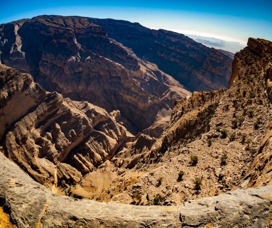
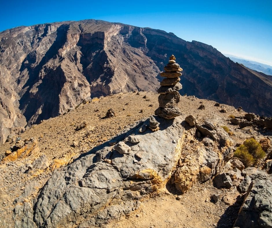
Along with Jebel Shams, all the mountains make a spectacular scenery that stuns the visitors. The Grand Canyon especially gives it an earth-shattering look to entice the tourist. Also, this Mountain is the place to receive the first sunlight of the day. People had built most of their houses with mud, and this takes you entirely back to that ancient time.


Camping
It’s a guarantee for you to have a terrific Mountain experience from Jebel Shams Oman. If you reach the peak of the Mountain, you’re likely to see two resorts: Jebel shams resort and the sunrise resort. You can pitch your tents and start enjoying the campfire with other guests. The alternatives will let you use their toilet no matter the guest package type. Please take a few blankets and sweatshirts as the Jebel shams weather is unpredictable. Choose a calm day of the year to avoid windy weather.
Stargazing
Imagine yourself on top of a 3000m mountain, and you’re gazing at the stars above your head with some other guests. The stars look bigger and more apparent than the regular stars, don’t they? Maybe because you’re now a lot closer to them than usual. The best time to visit Jebel Shams is April to October, as the sky is more transparent for stargazing.
Another thing you should notice is to observe the clear Milky Way if you’re not amongst the unfortunate ones. Is this what people call a win-win situation? You may want to put some heavy clothes on to feel snug as the Jebel Shams weather is colder at night.
Hiking
Love to hike the Rockies on your vacation? If you’re getting camping, stargazing, and hiking all in one place, then what else to ask for? This is Oman’s most popular hiking spot among the Jebel Shams hike. Let’s learn more about them.
Al Nakhur Rim Hike(W6 Route) Aka the Balcony Walk: Jebel Shams Balcony Walk:
will leave you amazed as you’re going to hike through the edges of the grand canyon. You hike alongside the wadi Ghul to the endpoint of the balcony walk and come back to the starting point again. This is a return hike. You get to see the beautiful scenery of the Hajar mountain range, wadi Ghul and so much more.
The Balcony trail is relatively narrow and risky for first-time hikers on such a path. But not an easy one for others either as the space is so tiny that only two people can move together. Even though, you’ll find places where two people may seem too much as well.
Consider the trip if you can’t walk for 1.5 to 2 hours straight with a few small resting sessions.
You’ll need to walk as much as 4km and 200 meters in elevation change. You start at the 1900m rim of the Grand Canyon, near a village Khateem, and end at 1700m down below where the abandoned village Sap Bani Khamis is.
Then you may want to take a bath on the cliff or sit down to take your meal. After that, it’s time to head towards the starting point again. It may seem a little tougher for you to walk on the way back as you’re climbing up with your poor tired legs. So you have to be a little more careful this time as you can stumble anytime.
Put on a pair of training shoes and kindly don’t go in jackets or heavy outfits. It’s not that cool in the daytime, and after walking hours, you’ll feel like having a heater inside your body. Take some clothes along if you plan to take a bath on the cliff.
Height Parameters:
● Starting elevation- 1,700m
● Ending elevation- 1,900m
Safety Tips:
● Don’t bother taking the pain if you’re a person who struggles to balance their feet when climbing the Rockies.
● Start the hike at least 4 hours before the sun goes down.
● You might find some barking dogs; if you have a phobia against animals, reconsider the hike.
Al Khitaym to Wadi Ghul Hike(W6a Route):
This is a Jebel Shams hike that you can start either way. Al khitaym is a village in Jebel Shams Oman that goes to the wadi ghul. So it’s your wish whether to start the hike from Al khitaym to Wadi Ghul or vice versa. The village is a lot below the canyon. So one way is ascending, and the other way is descending.
I’d recommend you do the climbing part first and then come back to the starting point because they advise us to do the tricky part first in trekking. This makes it a lot easier for an occasional hiker. But not an easier task to hike the steep drop-offs for people who fear heights. I hope you’re brave enough to nail this trail along with others. As no predictions are likely to work for Jebel shams weather, you should take at least a heavy cloth to protect you if the cold starts to spread.
If you started climbing up to the Grand Canyon and you’re a pro trekker with a muscular body, then expect to finish the hike in 3-3.5 hours. Sadly, not every person is as strong-, and thus, you’ve to waste a few minutes just walking alongside your partner. Once you reach the end of the trail, it’s now time to come back. If you can’t gather the courage to come down, take a vehicle to leave you to the previous point.
The Hike is around 7.5KM all the way, with a maximum elevation of 6,204 feet and a minimum of 2,471 feet. It’s a pretty heavy hike that is troublesome. To help you in this poor situation, plenty of water can provide salvation—no wonder why you should carry a few liters of water with you in the scorching sun.
Hike Parameters:
● Starting Elevation- around 900-1000m.
● Ending Elevation- 1900m.
Safety Tips:
● Walk on a pair of comfortable sneakers and wear lightweight clothes.
● Don’t take lots of stuff or a kid along. Otherwise, you’ll do more crying than hiking.
Jabal Shams Summit Hike(W4 Route)
Yet again, we bring you another mesmerizing hike in Jabal Shams, Jabal Shams summit hike. If you’re in the capital city, then the distance of Jebel Shams from Muscat is about 2.5 to 3 hours by car. Then take a car to the starting point of Jabal Shams summit hike to start the walk. The trail ends near the Jebel shams resorts, or it’s the starting point if you stayed at the spa or nearby the last night.
While hiking the trail, you may experience the Jebel Shams snow, which you won’t find in any other Jebel Shams hike. This hike will offer you the best sceneries of Jebel shams as no other trail did. Perfect for you if cold and windy weather is your priority for a hike. Don’t expect the paths to be well-paved because they aren’t. Some bloggers emphasized the trail is paved and smooth; maybe it isn’t that tough, but it isn’t a piece of cake either.
The scenery you’ll experience is a lot similar to the Wadi Ghul Balcony walk. It’s pretty much the same from a different angle. This is why some people feel a little bored while walking this trail. If you’re coming to Jebel Shams from Muscat or other cities to spend one or two days, then don’t go for both the hikes. Instead, choose any one of them to save some time to invest in other things.
Anyway, the route has flags on every corner to show you the right track for those who fear losing their way. These are helpful, and you can leave your map without any concern. Moreover, you’ll meet many other people accompanying you on the way that you won’t even get a chance to wonder which turn you need to take. So, don’t waste another day and come to the Oman Jebel Shams right away.
Hike Parameters:
● Starting elevation- 1,900m
● True Summit Elevation- 3,009m
Safety Tips:
● I hope you do well when to start a hefty hike in the Rockies. If you don’t, please start the walk in the early morning.
● Keep your feet balanced on taking every step. Take enough water and heavy clothes along.
● November to March is the month for rain. So Jebel Shams weather then makes the path tougher to navigate and then the chance to slip to the cliff.
Planning Map
Jebel Shams is a mountain from the Hajar Mountains range in Northeastern Oman and north of the Al Hamra town. This Mountain is the tallest peak of the country and the Arabian Gulf. If you’ve made up your mind to visit this great place, you need to know the way to get there. It’s best to rent a 4WD car to Jebel Shams as the road isn’t easy to drive at some point. You’ll likely find unpaved roads in the last 10km but not too bumpy either. Make sure to take lots of fluid and snacks along.
The best time to visit Jebel shams isn’t the rainy season which lasts from November to March. Then there are the other seven months of the year. You may make a trip to Oman Jebel Shams in these months and make it very memorable as the hikes are easier to walk at that time.
There are a few tour companies which you’ll come across on the web. I’d recommend Tripadvisor, Viator, and Tourhq. They’ll offer you an expert local travel guide, rent cars, and even guesthouses according to your needs.
As Jebel Shams is a spectacular touring spot, there you’ll find tons of hotels and resorts to stay. There are two resorts at the top of the Mountain. Then you’ll find two alternatives where you can stay or set your tent beside them. Other than this, there’re plenty of hotels near the ‘Mountain of Sun’ which offer you a luxurious night’s stay.
Visit TIPs:
● Again, choose sunny, dry weather for the tour. It’ll help you immensely, which you don’t have a hint of.
● Take some winter clothes, snacks, and your camping gear if you’re going camping purpose.
● The people there are amiable, but don’t hesitate to reach out to the military camp if you still face any problems.
● Try to drive in low gear at the last part of the road as that’s unpaved; better take a 4WD car.
● Wake up early in the morning to head towards the Mountain as there are lots of things to do and you need lots of time.
Hey There. I discovered your weblog the use of msn. This is a very well written article. I will be sure to bookmark it and return to read more of your useful info. Thanks for the post. I will certainly comeback.